Friday, November 29, 2019

Happy Thanksgiving !

Hello Everyone,

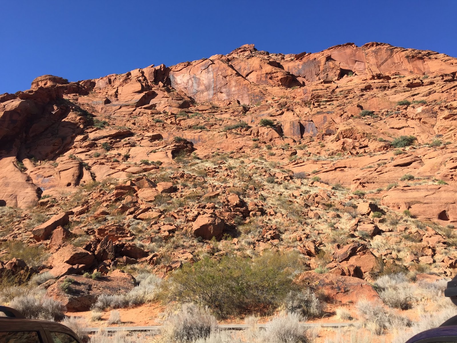
On Wednesday, Nov. 27th we drove 30 miles North to Hurricane, Utah, to the Quail Creek Reservoir and Quail Creek State Park. There we found several hiking trails, but a very nice park ranger told us the best ones were outside of the state park.

It was starting to get cloudy and the prediction was that showers were supposed to start n the afternoon so we quickly started on a trail that skirted part of the cliffs along the south side of the reservoir.

This is a photograph of the huge cement dam at the end of the reservoir is a newer version of the earthen dam that was replaced when it failed in 1989 causing a wall of water 40ft high to flood a large portion of the area below it including many private homes and businesses. People here were only given minutes to evacuate before the wall of water descended upon them.


As predicted the rain started to fall, right about the time of sunset that day and continued all night.

The next morning, Thursday, Nov. 28th, Thanksgiving Day we awoke to steady rainfall and a surprise. There was a Thanksgiving Day 10K run being conducted right across the street from our hotel. Hundreds of hardy participants were braving the cold rain to enjoy an annual event sponsored by the city of St. George, Utah.

We spent most of the day in the hotel watching a Harry Potter Movie marathon and sneaking out for a quick walk on the Virgin River Walkway between rain storms off and on during the entire day and night. It was very wet with many puddles to avoid even on the paved walkway that is well maintained by the city along the Virgin River that runs through the center of the valley and the city that surrounds it.
 Tomorrow, if the rain stops, we are hoping to do some more exploring around the area😊.

Tuesday, November 26, 2019

Red Rock Rec. Area & Snow Canyon SP

Hi Everyone,

On Monday, Nov. 25th we explored the Red Rock Recreation Area and the Pioneer Gardens, a part of the extensive city park system of St. George, Utah.

It was a warm day so there were lots of people out enjoying the Red Rock Canyon and climbing around on the promontories.


There were several slot canyons in the canyon so we were able to explore them while we were there.

One of the local inhabitants made an appearance on the edge of the cliff for us to photograph.

 Roadrunners are common among the rugged red rocks in this area.

 They were even a couple of arches at the top of the cliff.

On Tuesday, Nov. 26th we drove a few miles out of the city to the Snow Canyon State Park. This is a world-class park with a little of everything thrown in. A dormant volcano, beautiful red and white rock cliffs, snow-capped mountains, a creek, miles, and miles of great hiking trails, several campgrounds, rock climbers, and some entrances to extinct lava tubes.


White rock cliffs behind red sand canyons

Black rock basalt fields left behind by the volcano were strewn about the entire canyon. 


We watched the rock climbers for several minutes and marveled at their courage and/or foolhardiness? These two young women were several hundred feet up a sandstone cliff.

Notice that she has NO safety rope to protect her from a fall.


Again it was a nice day in the mid-fifties so we walked several miles along the paved trail that allowed cute puppies like me.

There is a cool sign at the beginning of the 3-mile paved trail that Dad found to be photo-worthy.

We even found ourselves in some unusual places, like upper Galoot and lower Galoot, two more places we have never been to before.


The lava fields drew our interest, especially the striations in the sandstone, which has been eroded by wind and water over the centuries.


There is even a sandstone arch on one cliff near the end of the park.

Tomorrow we are going to explore Quail Creek State Park and maybe Grafton Ghost-town😊.

Goodbye Moab - Goblin Valley SP

Hello Everyone,

On Saturday, Nov. 23rd we left Moab, Utah after spending an entire month there and exploring the area a well as we could. We visited Arches National Park nine different times, Canyonlands National Park four times and as many of the other attractions in the area as we could fit in.

We drove  120 miles back to Goblin Valley State Park for a second look under much different weather conditions. The first time we explored this wonderland of geological features in August, the temperature rose to over 100 degrees. This time it was only 50 degrees and we were able to spend much more time exploring because we didn't need to avoid the sweltering sun.


The white cliffs around the canyon edge were much more vivid in the cooler temperature.


The Goblin Army is still on the march along the top edge of the cliff.

Here is a two-headed Goblin right in the middle of the valley.

Donald Duck also made an appearance peering over the edge of this promontory.

It was great fun exploring all "Goblins" and regretted that we had to leave to finish our trip to the next place we were staying. So, we drove another 160 miles to Richfield, Utah.

On Sunday, Nov. 24th drove to  St. George, Utah where, to our great surprise, we found a nice "River Walk" not far from the My Place Hotel we stayed in. It is a paved bicycle and hiking trail that loops around the Virgin River that runs through the center of the city. 

Tomorrow we will start exploring the St. George area where there are several classy state parks😄.

Thursday, November 21, 2019

Hidden Valley Trail-Moab Utah

Hi Everyone,

On Tuesday, Nov. 19th we went back to the Hidden Valley Trail near Moab, Utah. We knew going in that the trail was very steep, climbing through a rocky pass to the top of the cliffs surrounding the Spanish Valley, South of Moab.

The ascent to the top is an 860-foot verticle rise which requires a scramble through large and small loose rocks (climbers call them rubble) for 3/4 of a mile, laughingly referred to by the locals as "Barney Rubble".

The further up the trail you hike the steeper and narrower the trail becomes, making it more challenging as one ascends toward the pass.


After you have hiked up and up and up, the pass looks only a short distance away, but there are still several hundred more feet to the top and then a 6-mile looping trail to follow at the peak

The view of the valley is breathtaking from up there, but we were exhausted and the weather was changing rapidly, so we started back down. (We still are not completely used to the elevation difference between here and home- 600-feet at home-8000-feet here in Utah. The air is thinner up this high and we become exhausted sooner)

On Wednesday, Nov. 20th the rain started in earnest and it poured a good part of the day and all through the night, which sufficiently curtailed our hiking activities. So we stayed dry inside and did some long-range planning on the next phase of our Great Adventure. The cloud cover was so thick we couldn't even see the mountains that surround the valley.

On Thursday, Nov. 21st the rain continued to fall and we noticed the La Sal Mountains that we had just explored a few days ago, were now covered with snow, especially the peaks. The rain subsided a little in the afternoon, so we took a quick walk around Ken's Lake again.

The weather is changing, winter is knocking on the door and it is time to head for a warmer climate South of here. Arizona and New Mexico are beckoning, so we are moving on, where we plan to visit the Grand Canyon.

Tomorrow we are going to be packing the car to move on to our next destination, St George, Utah😌.

Monday, November 18, 2019

The La Sal Mountains -Utah

Hello Everyone,

On Monday, Nov. 18th we drove up into the La Sal Mountains, South-East of Moab, Utah. The La Sal Mountain Loop Road is a 62-mile long scenic byway that winds its way up and around the La Sal Mountains.

 The views were breathtakingly beautiful as we drove along the top of the mountain passes. The day was hazy again, so some of these pictures are a little fuzzy in the distance. These mountain peaks range from 13,000 to 14,000 feet high.

Near the top, there was a dirt road turn-off that leads to Warner Lake, a nice alpine lake that overlooks the valley.

The road was a bit scary, especially the switch-backs, some of which had to be taken at a crawl.


As we came down the other side of the mountain road we could see the Colorado River in the far distance.

Castle Rock is a local landmark that can be seen from thirty or more miles away.

The village of Castle Rock Valley is at the base of the mountains, just below Castle Rock.

The La Sal Mountain Loop terminates at Route 128 adjacent to the mighty Colorado River.

On the way home to Moab, we stopped at the Moab Museum of Western Film in the Red Cliff Lodge at Castle Creek. The museum holds memorabilia from the 120 movies and TV shows that have been filmed in the Moab area. 

Such movies as Thelma and Louise, Indiana Jones and the Last Crusade, Easy Rider, The Trial of Billy Jack, Back to the Future III, City Slickers II, Star Trek, Con-Air, National Lampoon's Vacation, The Adventures of Joe Dirt, Mission Impossible II, Vertical Limit, and recently The Lone Ranger, Transformers 4 and Need for Speed have been filmed there.

Also, numerous John Wayne classic movies like Stagecoach, Rio Grande, Fort Apache, The Searchers, The Comancheros, She Wore a Yellow Ribbon, Cheyenne Autumn, and many more. Dad had a great time exploring the museum while Mom and I went for a nice walk along the Colorado River around Red Cliff Lodge.

Tomorrow we are going to explore the Hidden Valley Trail, up over the western cliffs of Spanish Valley, outside of Moab, Utah. Wish us luck, it is very steep and rocky😊.


Sunday, November 17, 2019

Needles District -Canyonlands National Park

Hi Everyone,

On Sunday, Nov.17th we drove forty miles South on Route 191 and twenty miles West, to the Needles District of Canyonlands National Park.


This vast canyon is so immense it is hard to imagine its size unless you are there to take it all in.

It is half as deep as the Grand Canyon and half as wide, but all the same, awe-inspiring.

The mighty Colorado River has had centuries to carve out this extensive canyon complex and the results are mesmerizing.

It was very hazy, cold, and windy as we tried to get some clear pictures to include in our report to you.


We found a rather unique viewpoint to observe the canyon from, and Mom says the next time Dad starts growling like a bear he can use this as his winter home. (When Dad gets tired or hungry he starts growling at other drivers...like a bear).


There are three distinctive districts to Canyonland NP, and we have seen two of them, Island in the Sky and Needles. The remaining district is called "the Maze" and requires a high clearance all-terrain vehicle to go into it and explore the area. Also, all of the guide books strongly recommend that people interested in exploring the area take an experienced guide with them to avoid getting lost and allow up to a week to see the whole thing, requiring them to camp in the desert overnight for several days. Yikes!

On the road to the Needles District, we happened across an interesting site along the road. This huge rock, about the size of a football field, appeared to be growing in the middle of this hayfield.

On the way home, we discovered yet another arch along Route 191 between Monticello and Moab, Utah, Lopez Arch. Not very big, but non-the-less an arch.


We also got a glimpse of the La Sal Mountains in the distance on the way back to Moab.

Tomorrow we are going to explore the La Sal Mountains, South-East of Moab😉.