Tuesday, January 17, 2023

Farewell My Freinds


My retired human parents and I settled in Sun City, Arizona in a nice house on a quiet street where we could take daily walks in a very friendly neighborhood called Quail Run. I made many new friends with the friendly people who live here and their four-legged companions too.

On January 17, 2023, just as I reached my 14th birthday, after a valiant and protracted battle against prostate cancer for the past seven months, cancer finally won.

I consider myself very fortunate to have known all of you wonderful people and hope that all of you in some small way enjoyed following my adventures with my wonderful family. It was a hoot!

I only regret that I won't be able to continue to dictate these adventures so my dad can type them anymore. I suppose he might be able to blunder through without me helping him on their next trip.

Alas, all good things must come to an end. God bless you one and all!

Saturday, July 24, 2021

Joshua Tree National Park & Homeward Bound

Hello Friends,

On Wednesday, July 21st,  we took a short trip around a scenic route near Oakhurst, CA, and the Bass Lake area. Then we returned to the nice studio apartment we were staying and packed up our things for the trip home to Sun City, AZ. 

In the afternoon we planned the next part of our trip and had a nice conversation with James, our host in Coarsegold, CA. He is a very nice man and we became friends right away. He said my tongue tickled when I licked his hand.


On Thursday, July 22nd, we left Coarsegold early in the morning hoping to get past Fresno, CA before the morning rush hour. Fortunately, we did manage to do just that and traffic was reasonable with little delay. 

Dad drove 274 miles over small mountains and foothills to get us to Mohave, CA, a rather unique town in the desert on a high plateau between mountain ranges in the Mohave Desert. The first thing we saw as we came down off the mountain was miles and miles of wind turbines.


It appears that California is ahead of the rest of our country when it comes to alternative power sources.

Next, we saw something that few people get to see, a commercial airplane parking lot in front of a small desert airport with several big hangers. There must have been nearly one hundred planes there of every shape, size, and color.


Not far away, is Edwards Airforce Base and Spaceport, where the Challenger spacecraft landed after each mission into space. 


On Friday, July 23rd, we drove past Edwards Airforce Base and Spaceport in the morning, but couldn't see very much from the highway. We were told by the locals that the famous "Boneyard", a junkyard for airplanes, that was filmed in the action movie "Conair", was nearby, but we didn't take the time to go visit it.

Dad drove another 143 miles through the high desert to Joshua Tree National Park.


The temperature rose to 109 degrees, so we spent very little time outside our airconditioned car.

The trees were interesting and plentiful, miles and miles of them actually.


Along with these unique trees, there were many interesting rock formations as well. Many of the formations looked like some giants had decided to make huge piles of rocks in the desert to play with later and then forgot them.


This one looks like an elephant laying down.


Some of them even have names. This one is called "Skull Rock".


There were desert animals too, and some even have their very own crosswalks.


As we drove on through the park the landscape began to change and the Joshua trees disappeared as we dropped in altitude. Another species replaced them. Cactus plants called "Cholla cactus" were as abundant as the Joshua trees had been in the higher altitudes of the park.


It takes over two hours to drive through the entire park without stops, so it took more time than that for us to drive through to the others side. On the other side was the Cottonwood Visitor's Center where we stopped for a quick break.


So, we said goodbye to the National Park and pushed on to our next hotel in Indio, CA.


Tomorrow we expect to drive the last 200+ miles back into Arizona and on to Pheonix, and Peoria.

That's it for now, phase three of our Great adventure has ended. 

We will be planning a new adventure into Oregon, Washington State, and the Pacific coast of California later this year or early next year😃. 


Wednesday, July 21, 2021

Bass Lake California

 Hello Everyone,

On Tuesday, July 20th, we drove back up Highway 41 to Oakhurst, CA, and a little further on to Bass Lake, a local attraction in the Sierra Nevada mountain foothills, a part of the Sierra National Forest.

Bass Lake is a manmade lake, 4 miles long and 1/2 mile wide, that was constructed in 1910 by creating a 147-foot earthen dam in the Crane Valley to hold back the waters of Willow Creek. Originally it was intended to be used for purposes of producing electrical power for the communities in the area. However, it didn't take long for the recreational value of it to show through as throngs of people flocked to the area in the summer to swim, go fishing, go for a picnic, go camping, or go boating. 

Today, Bass Lake is advertised as: "The Gateway to Sierra Adventure".


We spent nearly half a day exploring the lake and picnic grounds around the lake.


We had our take-along lunch at one of several picnic groves along the shore.


The lake was beautiful and many families were enjoying themselves in the water and around the shore. 


It was a fun day, but I wasn't feeling too well so Mom and Dad took me back to our studio apartment in Coarsegold, CA to rest.

Tomorrow we will start packing for the three-day trip home to Sun City, with one more stop at Joshua Tree National Park near the border between California and Arizona. See you then😎.


Tuesday, July 20, 2021

Yosemite Valley

 Hello Friends,

On Monday, July 19th, we got up early again, to get into the park before the hordes of visitors arrive at around ten o'clock. Even with the reservations that are required to get into Yosemite National Park, the valley in particular, is crawling with visitors by noon each day and weekends are even more crowded.

After driving only a short distance into the valley we encountered even more devastation left behind by a wildfire that happened last year. It's so sad to see the ruins of such beautiful forests due to these wildfires. Even our national icons are not immune to this devastation.


There were places where we saw entire mountains nearly completely denuded of trees or vegetation from forest fires. How sad!

We drove to the far end of the valley and found a parking spot at the trailhead to Mirror Lake.


The trail was almost three miles, but we had some company on the trail with a visit from one of the local residents who stopped by. The mule deer have such big ears, but their tail is much smaller than the White-Tailed Deer in the East.


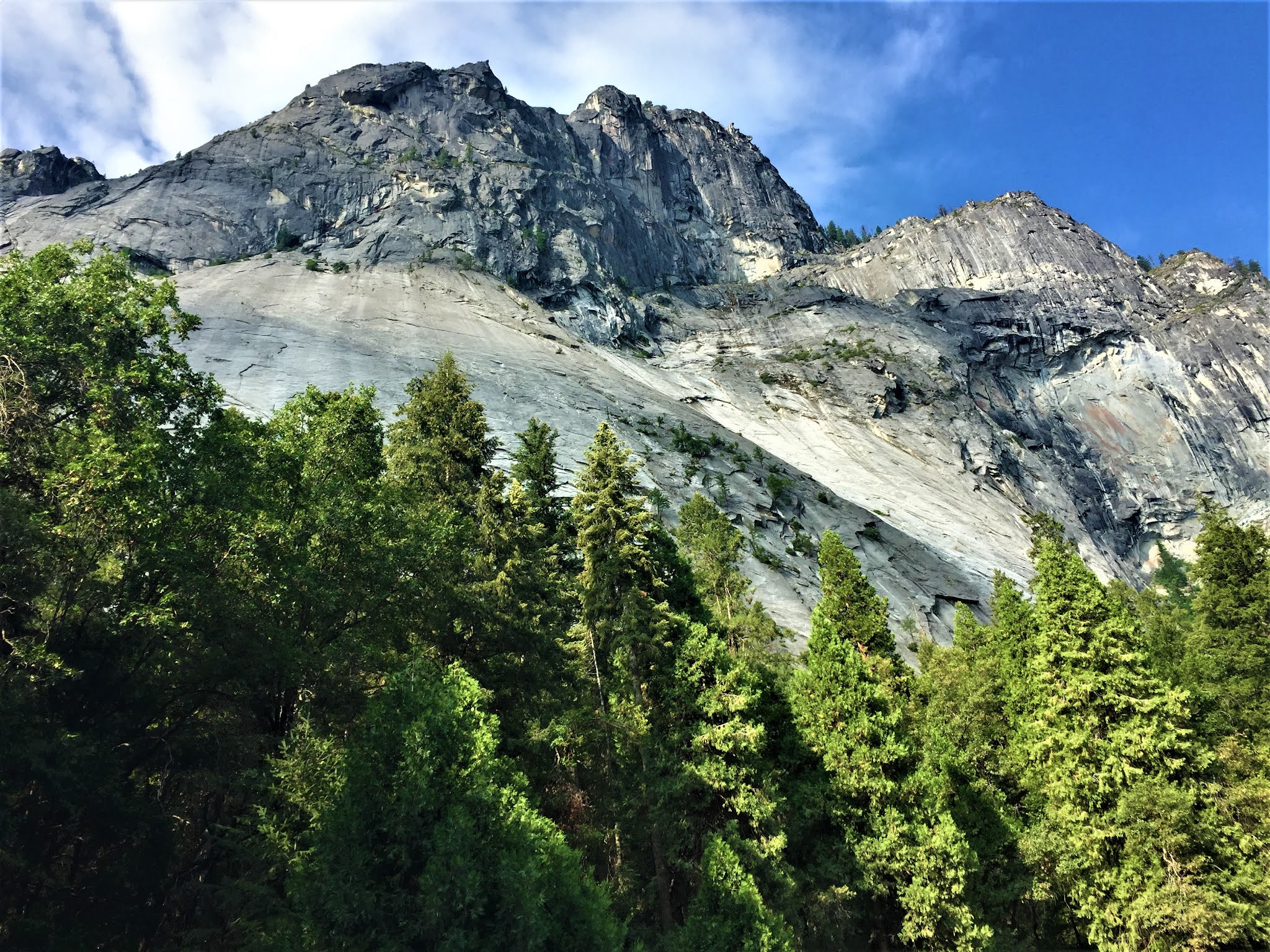
Unfortunately, when we reached Mirror Lake there was very little water in it, nowhere near enough to reflect Half Dome or North Dome, which is what it is famous for.


 So we hiked back to the car and went searching for other icons to photograph.

Three Brothers (Eagle Peak the highest one 7,779 ft.)


El Capitan in all its glory (7,569 ft.).
Climbers come from all over the world journey here to climb this challenging sheer-sided granite edifice. It often takes climbers three days to reach the top.


Half Dome (8,836 ft.)
There were people climbing up the backside of it, using a steel cable to haul themselves up to the top.


In 1864, during the waning days of the American Civil War, Present Abraham Lincoln signed the bill that set aside the Yosemite Valley and the Mariposa Giant Sequoia Grove, nearly 50 years before the National Park Service came into existence. This park has been mostly protected by the State of California and or the federal government one way or another since then.

Lastly, we stopped to catch the grandeur of the valley from the Valley View Tunnel with a storm coming into Yosemite Valley.


We decided to leave the park at that point because Dad didn't want to drive on those narrow, winding mountain roads, with no guardrails, in a thunderstorm all the way back to Coarsegold, Ca where we are staying for the next few days. It is scary enough when the sun is out. A downpour would be very frightening.

Tomorrow we will be visiting a local landmark near Oakhurst, CA. Bass Lake will be the place for our next adventure😉.


Yosemite National Park

 Hi Friends.

On Sunday, July 18th, we hopped out of bed at 5:00AM, packed the car, ate a quick breakfast, and left for Yosemite National Park at 6:00 AM so we could get to the park before the hordes of tourists showed up.

Yosemite has a reservation system now to reduce the number of people in the park that requires one to go online and apply for a reservation, and once that is accomplished, the reservation has to be printed out for presentation at the entrance gate (they will accept a digital version reluctantly).

The shuttle buses are still not operating so they have to cut down on the number of vehicles allowed in or become overwhelmed with too many vehicles by mid-morning. The visitor's centers are also not open to the public yet and a small kiosk has been set up in the parking lot at only two locations, Yosemite Valley and Lambert Dome, maned only to pass out brochures and answer questions.

We entered the park through Tioga Pass (11,523 ft.), from the village of Lee Vining (6,837 ft.) on the eastern side of the Sierra Nevada Mountains. That nearly 5,000-foot climb up the mountain to the entrance station is just breathtaking. 


The first big attraction from the Eastern entrance is Lambert Dome, a huge granite dome extending above the tree line and gleaming in the sun.


From there we drove past Tuolumne Meadows but didn't get out to hike, because cute puppies like me, are not allowed on the trails there. There are only a few places in the park where dogs are allowed to accompany their human families on a nice hike.

From there we stopped at Olmstead point again to get some more pictures of Yosemite Valley from the eastern side.

That's Half Dome sticking up so prominently.


Next, we headed to Tuolumne Grove, one of the places I could hike with Mom and Dad, and explore the Giant Sequoia trees that grow there. On the way, though we came upon something we had not anticipated. 

There had been a wildfire along the Tioga Road near Porcupine Flat four days before we got there, and there we several firefighters near the road monitoring the still-smoldering remnants of the forest that had been devastated by the fire which had been started by a lightning strike.


We finally got to take a hike at the grove of Giant Sequoia trees and really enjoyed the two-mile walk down into the valley, and the hike back up to the parking lot too.


This tree is named Big Red, it is over 300 feet tall and about 28 feet around.


Here's one so big, they built a road so you could drive a small car through it.


 These trees are gigantic, some of them 300 feet high, as big as 25 feet wide at the base, and some are 300 to 500 years old. 

From there, we went on to Yosemite Valley and captured some of the grandeur of the iconic landmarks that reside there.


Tomorrow we will be coming back to the National Park to explore more of Yosemite Valley😊.