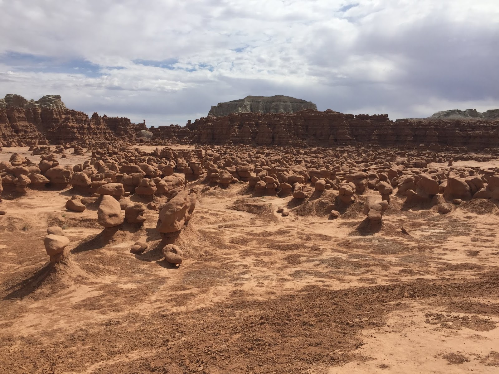
On Tuesday, Sept. 3rd, we drove out into the central Utah desert to a unique state park called Goblin Valley. What a great place!

I made friends with some nice senior citizens who were there in a tour group enjoying the scenery just like us. This valley is full of odd-shaped monoliths that bear a striking resemblance to goblins.
Near the entrance to the valley, there are "Three Sisters" that appear to be guarding the place.

Further on there were more sentries overlooking the valley and appearing to be on guard against intruders.

Over on one side, there was goblin army on the march along the rim of the canyon.

Here's Dad clowning around as he peers through a portal in the rock formations.

We had a lot of fun hiking among the "goblins", but we couldn't stay long because it was over 100 degrees in the valley (much too hot for me).


Later, we drove another 80 miles to Capitol Reef National Park near Torrey, Utah, where we spent the night in an interesting but somewhat older motel in the center of the town. Surprisingly, the restaurant attached to the motel had reasonable vegan food for us to eat that evening.


On Wednesday, Sept. 4th, we drove ten miles back to Capitol Reef National Park and began exploring it more thoroughly. Capitol Reef is a one hundred miles long geological fold created by intense pressure from two tectonic plates colliding about 75 million years ago, pushing the earth's surface up above its normal position (several hundred feet actually).


This feature is called Chimney Rock, several hundred feet high, near the West side of the park.

This feature is Capitol Dome peak, looking up from the valley floor, along Route 24, the main artery through the park.

Back in the 1880s a group of ten Mormon families established a settlement in the valley and raised crops to sustain themselves, and for sale to others. They were successful mostly with fruit. Today the orchards have been restored and the visiting public can pick fresh fruit right from the trees.

We picked some very tasty peaches but didn't stay long because the temperature shot up to 95 very quickly.

Then we drove through a ten-mile scenic byway through Capital Gorge to view many more spectacular sites.

It was an unimproved road, mostly red clay and sand, so we didn't drive the whole length of it. We turned around after ten miles and returned back to the main part of the park and paved roads.


The bright red stone at the base of this cliff is called Navajo sandstone.

From there we drove up the main road through the park to a trailhead leading to Hickman's Natural Bridge, Again, I wasn't allowed on the trail, so Mom and I waited at the parking lot and made friends with a nice man whose wife had left him there while she hiked up the steep trail to view the natural bridge. He said he wasn't able to climb such a steep trail so we chatted with him while he waited.

Dad really wanted to see the natural bridge and try the hiking trail so he hiked 1.5 miles up a steep cliff to the top so he could see it. Unlike most other natural bridges that exist in river valleys, this one is at the top of a mountain. Look closely above Dad, and you can see the natural bridge which is 133 feet across at the opening.

While he was up there he took another much closer picture of Capitol Dome peak which is the peak that the reef and the park are named after. An early visitor to the park, a US Congressman, said the peak reminded him of the Capitol dome in Washington, and that is how the reef got its name.

After Dad came back down the steep mountain trail, we drove a little further on to stop and see some more petroglyphs along the highway leading through the park.


These petroglyphs were left by the ancestors of the modern-day Hopi, Zuni, and Paiute Indian tribes.

Near the end of the day, we drove 120 more miles to Panguitch, Utah where we will be staying for the next week.
Tomorrow we will spend the day exploring Bryce Canyon National Park 😌
No comments:
Post a Comment